
|

1970 Soil Survey
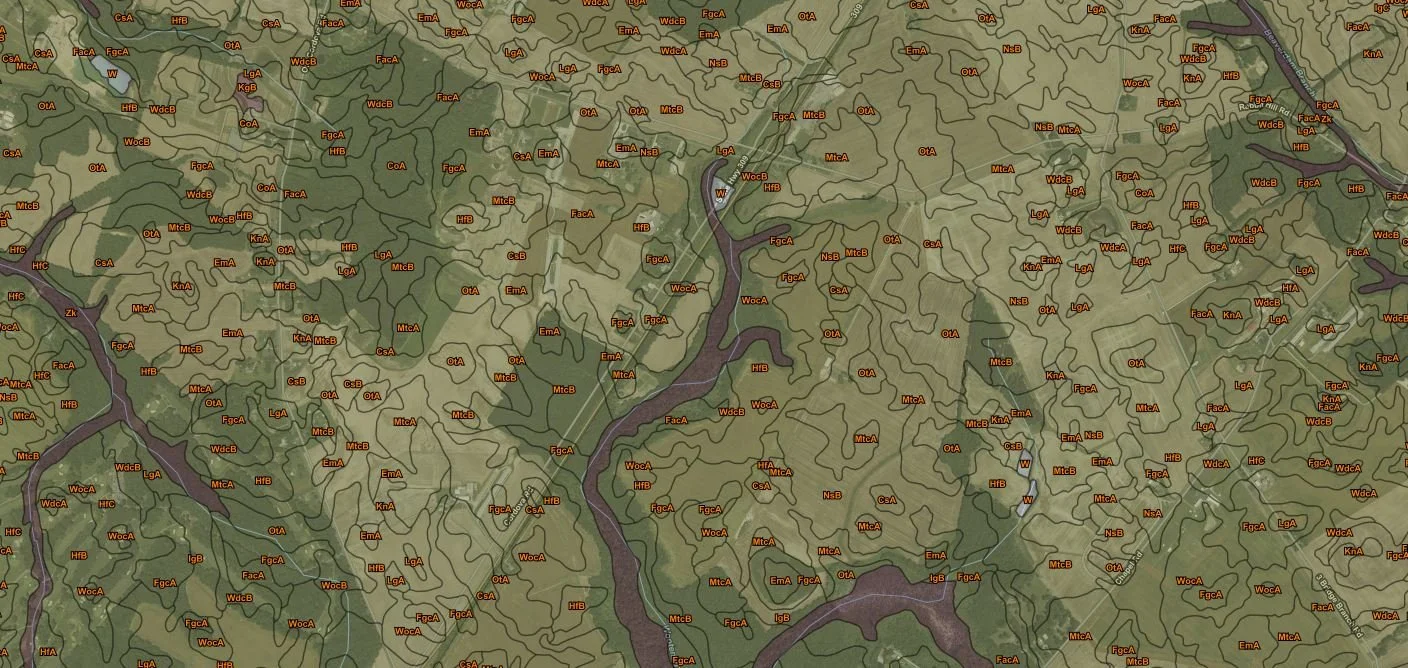
The initial Talbot County Soil Survey was completed in 1970 and contained information that could be applied in managing farms and woodland; in selecting sites for roads, ponds, buildings, or other structures; and in judging the suitability of tracts of land for farming, industry, or recreation. The survey consisted of detailed maps with soil areas outlined and identified by symbol. This survey is still available at the office for viewing.
An updated survey with a new soil naming system was completed in 2008 and can be accessible from the internet by using the Web Soil Survey. This tool allows users to select an area of interest (AOI) in Talbot County and provide detailed interpretations for the area based on the soils.

Annie Rossi and Jim Brewer, NRCS Soil Scientists
Contact:
Annie Rossi
NRCS Soil Scientist
443-746-4313
James Brewer, CPSS/SCC
NRCS Resource Soil Scientist
443-746-4319
|
|
To learn more, visit https://www.nrcs.usda.gov/wps/portal/nrcs/detail/md/home/?cid=NRCSEPRD1426845